Elevation.
An elevation is a two-dimensional orthogonal drawing that shows a building's exterior (or interior wall) as if viewed straight-on from a fixed distance, displaying height, vertical proportions, and surface details without perspective distortion.
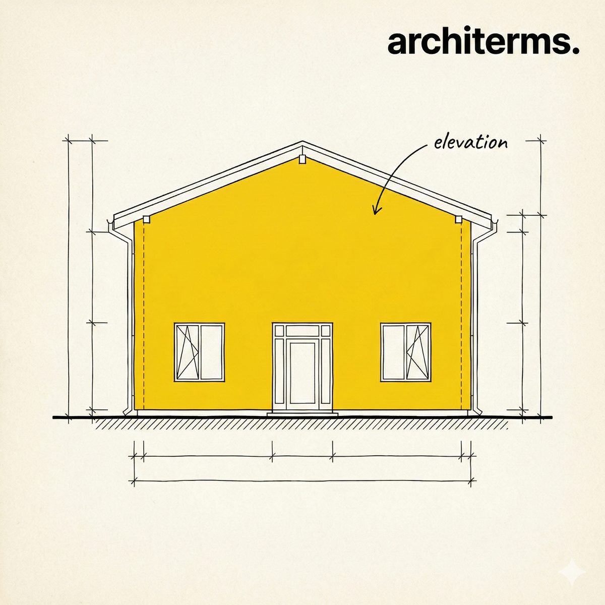
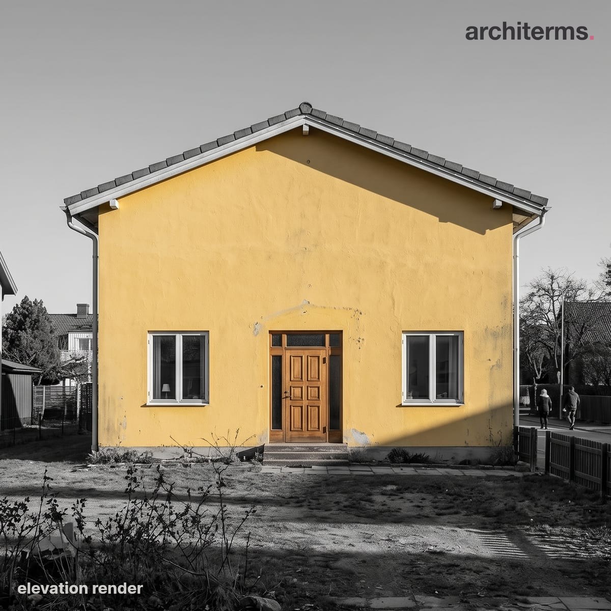
An elevation projects a building's face straight onto the paper, with every point drawn as if seen from the same fixed distance. Because the lines stay parallel rather than converging, heights and vertical proportions read at true scale without perspective distortion.
Made with Reviz.Design — AI visualization for architects and interior designers
Definition
An elevation is one of the core architectural drawing types because it reveals what a building looks like from the side—literally what you see when you stand in front of it and look straight ahead. Unlike a photograph, an elevation is drawn to scale and is orthogonal (all lines are either horizontal or vertical), so it doesn't compress distant features the way perspective does. This makes elevations essential for understanding a building's true proportions, material transitions, window placement, and facade composition.
Elevations are typically labeled by direction: north elevation, south elevation, east elevation, and west elevation. Each one captures a different face of the building, showing how the design responds to orientation, sun exposure, and context. Because elevations flatten a three-dimensional object into a two-dimensional plane, they work best alongside other drawings—floor plans show how spaces are organized horizontally, while sections reveal interior heights and depths that elevations alone cannot convey.
An elevation is a scaled, orthogonal projection of a building's exterior (or sometimes interior) wall surface viewed perpendicularly. It shows the vertical arrangement of fenestration, facade materials, cornice lines, roof edges, and other surface features as they appear when looking directly at that side of the building. The term comes from the idea of "raising" or showing the profile of something. In practice, elevations form a complete set—typically four cardinal directions—that, combined with a floor plan and section, give a designer and builder a complete understanding of the building's geometry and appearance.
Elevation History
Elevations emerged as a fundamental tool during the Renaissance when architects began using systematic projection methods to communicate designs precisely. Before printed architectural standards, buildings were often conveyed through written description or perspectival sketches. As construction grew more complex and buildings became larger, orthogonal projections—including elevations—became the industry standard. Brunelleschi and later Renaissance masters refined the practice, and by the 17th and 18th centuries, elevation drawings were as essential to a building design as the building itself.
During the 19th and 20th centuries, the conventions of elevation drawing became codified in architectural education and professional practice. Art Deco and International Style architects used elevations to emphasize massing, rhythmic fenestration patterns, and clean horizontal or vertical lines. Modernists valued elevations as honest diagrams of structure and function. Today, digital tools have made elevation drawing faster and more flexible, but the fundamental principle—orthogonal, scaled representation of a vertical face—remains unchanged.
Elevation in Architecture
Elevations serve several crucial roles in architectural practice:
- —Design communication: Elevations let architects and clients agree on how a building looks from public viewpoints.
- —Urban integration: Elevations show how a building fits within its context—how its height, setbacks, and street-facing materials relate to neighboring buildings and the public realm, a concern central to contextualism and placemaking.
- —Construction documentation: Builders and contractors use elevations to understand what materials go where, how windows and doors are positioned, and how the building envelope is assembled.
- —Regulatory compliance: Zoning boards and planning departments review elevations to check setbacks, heights, and facade proportions against code requirements.
Elevations can be rendered simply (line drawings showing only the outline and major features) or elaborately (with materials, shadows, textures, and surrounding context). Many architects now produce "rendered elevations" that show how materials and lighting will affect the building's appearance—especially important for understanding how Double-Skin Facade systems or Brise-soleil shade devices will perform and look.
Common confusion
Elevation vs. section: A section is a vertical slice through the building that shows interior heights, floor levels, roof structure, and spatial relationships in depth. An elevation is a flat side view of the exterior (or a wall surface) showing only what appears on that face.
Elevation vs. perspective: A perspective drawing uses vanishing points and converging lines to create a three-dimensional illusion, as the eye would see it. An elevation is orthogonal and to scale—it doesn't distort distance and is always drawn from an infinite viewpoint.
Elevation vs. facade: Facade refers to the actual building exterior (the physical surface); elevation is the drawing that represents it.
Elevation vs. floor plan: A floor plan is a horizontal orthogonal projection looking down at a building from above, showing room layout and circulation. An elevation is a vertical orthogonal projection looking at the building from the side, showing vertical features and proportions. Both are essential to understanding a design, and in the Architerms architecture glossary, you'll find detailed guidance on how to read and use both drawing types together.
Frequently Asked Questions
What is an elevation in architecture?
An elevation is a scaled, orthogonal (straight-on) drawing that shows one vertical face of a building or interior wall. It displays height, proportions, window placement, materials, and surface details as they would appear when looking directly at that side of the building. Elevations are essential architectural drawing tools used in design, planning, and construction.
What is the difference between an elevation and a section?
An elevation shows the exterior (or wall surface) of a building from a straight-on viewpoint, revealing what appears on that flat face. A section is a vertical slice through the building that shows interior depths, floor heights, roof structure, and how spaces relate vertically. Elevations show width and height; sections show depth and interior relationships.
Why are elevations important in architecture?
Elevations communicate design intent to clients and builders, show how a building integrates with its surroundings, allow architects to work out facade details and proportions, and provide the scaled documentation needed for construction and regulatory review. They are one of the three fundamental orthogonal drawings, alongside floor plans and sections, that fully describe a building's design.
How many elevations does a building need?
Most buildings require four cardinal elevations (north, south, east, and west) to show all four sides. Complex buildings with irregular shapes or significant facades facing other directions may require additional elevations. The number depends on the building's form, the project requirements, and what the design team needs to communicate clearly.
What information should be shown on an elevation drawing?
Elevations typically include the building outline, window and door openings, roof lines, material transitions and finishes, major structural or decorative features (like cornices, pediments, or brise-soleil), grade line, and relevant dimensions and notes. Rendered elevations may also show materials, colors, shadows, and surrounding context to convey the final appearance.